Search This Blog

Followers

Wednesday, February 29, 2012

Google Earth Check 2

Let's get it started
We did a little more experimentation with our GPS track and the accuracy of Google Earth.  The ground-level extrapolation is pretty accurate.  The Garmin GPS appears to be within about five feet of actual position; can't ask for better than that.  We did a fairly long hike while utilizing the GPS device, and much of the fun is seeing the track displayed on Google Earth, where you can play with all types of different perspectives.  The final image is a Google Earth aerial overview of our progress along and then down through an arroyo.
Giant Yuccas in the outback

Google Earth view west of Tortugas Mountain

Google Earth view of outer loop road

Compare this photo of the outer loop road

Google Earth extrapolation of outer loop road

Photo of outer loop road

Google Earth image heading north from Tortugas

Google Earth perspective from Waypoint #8


Photo from Waypoint #8


An overview of our hike from the north using Google Earth


Tuesday, February 28, 2012

How Accurate is Google Earth?

Setting off through the desert
Just out of curiosity I opened our GPS track on Google Earth, then monkeyed around with various perspectives (including "Ground Level View") to test how accurate Google Earth is.  I came away from the experiment pretty impressed.  Even when I went down to ground level, the computer-generated image of the landscape was fairly accurate.  Even though I was impressed with Google Earth's capabilities, Becca could care less.

Giant Yucca on the foothills trail


Garmin GPS track on Google Earth

Out of the foothills into the lower desert


Google Earth view:  Tortugas (left) and Organ Mountains


Bushwhacking from right, then on dirt road

Back up into the foothills (centerline) then down (foreground)

Google Earth view of the dirt road to-and-from the mountain

Monday, February 27, 2012

Resupply Day Hike

We had an abbreviated outing this morning because I had to go grocery shopping--one of my favorite activities.  Becca and I had a good time nonetheless because the weather was fantastic.  I'm getting spring fever even though I know there's more winter to come.

Sunday, February 26, 2012

Sunday Scramble

Always at the ready


Dr. K, Becca and I did a moderately-long hike around Tortugas Mountain this morning.  It was somewhat breezy and chilly when we started off, but the weather soon turned nice.  We put a few miles on our paws before heading back to the car, which we parked near the Sunset recreation area.  Not surprisingly, it was pretty jam-packed with outdoor enthusiasts taking advantage of the springlike day.  As of this writing it is 70 degrees Farenheit, headed for a high of 73.  We're supposed to be 75 tomorrow.  Hard to believe it's still February.

Saturday, February 25, 2012

West of Tortugas

At the head of the Crosscut Trail
Owing to the strenuousness of our hike yesterday, and the fact that my old knees cannot handle the stress they used to take, we did a shorter hike west of Tortugas (Tortoise) Mountain this morning.  She didn't have to say anything, but I know Becca was protesting the shorter trek vociferously.  We had a good time nonetheless.  The last image is a Google earth screen shot that clearly shows one of the large arroyos we hiked through.
In an arroyo west of the mountain


Heading back

Claret Cup Cactus beginning to bud

Becca and the mountain
Section of our track superimposed over a Google earth screen capture

Friday, February 24, 2012

Atop Tortugas


Starting up the mountain
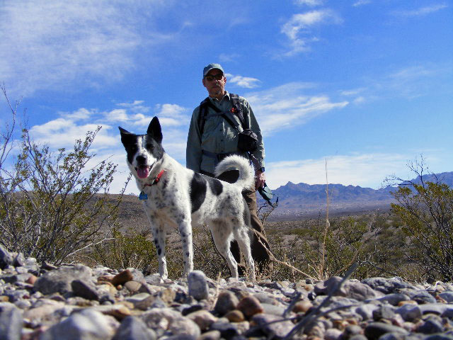
It had been quite a while since we hiked to the top of Tortugas Mountain, so we set off on a west-side ascent this morning.  Although the mountain is 4,931 feet in elevation, the prominence from where we started is only about 600 feet.  Nevertheless, the way we go is a butt-kicking 600 feet, and I have to stop several times enroute.  Becca, of course, only stops because I do.  Tortugas Mountain is sacred to the Native Americans of nearby Tortugas Pueblo.  It is also the site of several observatories from New Mexico State University.  The initial image here is our GPS track overlayed on Google Earth.
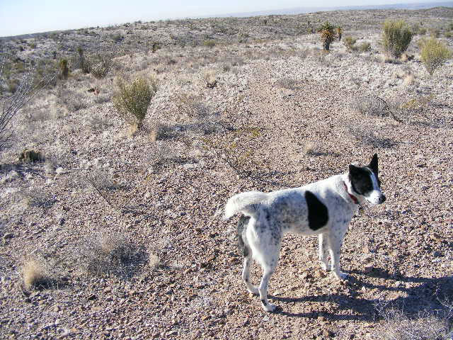
One-eighth of the way up


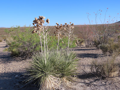
Agave lechuguilla (aka shin dagger)

Large round mounds of Strawberry Pitaya Cactus


One-fourth of the way up

Three-fourths of the way up

Up.  The old observatory atop Tortugas Mountain

Looking east toward the Organ Mountains from atop Tortugas

Tortugas Pueblo shrine at the mountain crest


Ceremonial votif candles

Looking down to the west from the summit


Sun rising above the old observatory

The steep northern flank of Tortugas


Vast stretch of desert, Organ Mountains on the horizon


Heading down


The new Centennial High School from altitude


Thursday, February 23, 2012

Extra Long Hike

The western flank of Tortugas and the Organ Mountains
Becca and I started off at the parking area near the road to the top of Tortugas Mountain, took the Crosscut Trail to the far outer loop road, then followed a dirt road for miles away from the mountain.  Along the way we discovered an intricate rock cross and a silly stick figure on a rise.  For those who think the desert is a flat plane punctuated now and again by mountain ranges, take a look at some of the rolling terrain.  Makes for a great workout.
The rolling Chihuahuan Desert

Looking back the way we came

Small Mesquite Tree and the Organ Mountains

Somebody took the trouble to fashion an intricate rock cross

Even further west of Tortugas Mountain

A funny stick figure somebody made

Beautiful sky

Homes at the edge of the desert in the Las Alturas neighborhood

Camera shy?  I don't think so

Bad Day All Around

Rest in peace, best male heeler ever.  Our beloved Frio The first thing we did this morning was to take Frio to the vet to put him out of hi...